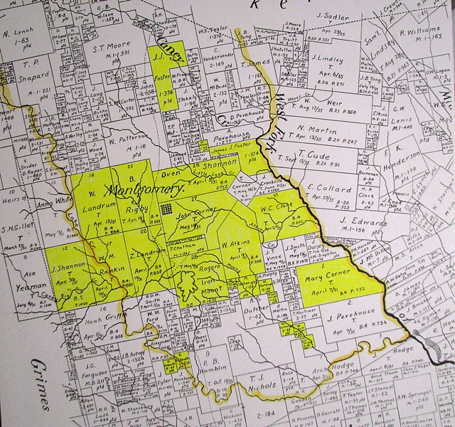
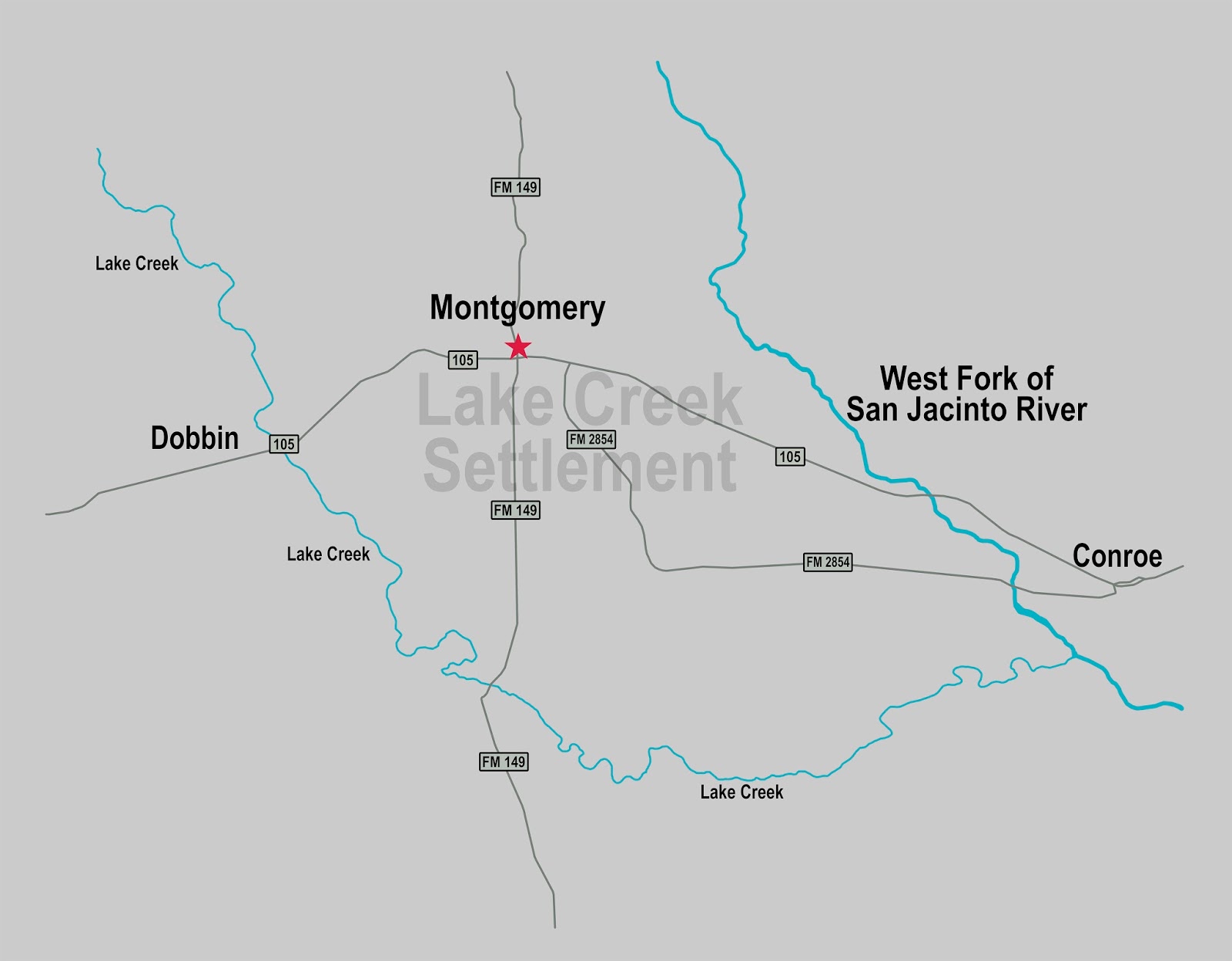
Map of the Lake Creek SettlementClick Here To Read Lake Creek Settlement Narrative History Below is a scan of an 1861 map of Montgomery County which has been highlighted to show the lands previously known as the Lake Creek Settlement. Use this map to locate the land grants of persons named in the records included on this site. To see this map enlarged, click on the map. Map of Lake Creek Settlement The Lake Creek Settlement was bounded by the West Fork of the San Jacinto River on its east side and by the stream named Lake Creek on its south and west sides. A number of early settlers received land grants within the boundaries of what became known as the Lake Creek Settlement. The land grants highlighted on this map indicate the land owners and/or real estate mentioned by name in the Lake Creek Settlement documents listed on the Home page. These documents give us a very good idea of where the Lake Creek Settlement was located and its approximate size.
It is important to note that the lands west of the West Fork of the San Jacinto River on this map were located in Austin's Colony. The lands east of the West Fork of the San Jacinto River on this map were located in Vehlein's Colony. The lands on the Austin's Colony side of the the West Fork were granted in 1831 and the lands on the Vehlein's Colony side of the West Fork were granted four years later in 1835. This map was prepared for the 2017 dedication ceremony for the Texas Historical Commission marker approved in 2016 for the Lake Creek Settlement. The map shows the location of present-day roads, towns and cities with regard to where the Lake Creek Settlement was located. |

